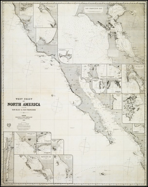
West Coast of North America from San Blas to San francisco...
Cartographer:
Imray, James
Date of Creation:
1870
Chart of the West Coast of California from the harbour of San Blas in Mexico to north of San Francisco Bay, with the Gulf of California and the Baja peninsula, and numerous insets of bays and ports.
First edition in this format, Imray having first published a similar chart in 1849. It remained the standard commercial chart of the region for the next twenty years.
"Imray's own particular interest was in chart compilation and he expanded his list beyond home trade waters with new charts of American and eastern seas. The publication of sailing directions, the manufacture and sale of nautical instruments (with which the firm had widened its services to navigators), and the nautical academy all flourished. In 1854, when his elder son, James Frederick Imray (1829–1891), became a partner in the book and instrument sides of the business, the firm became James Imray & Son" (Susanna Fisher for DNB).
