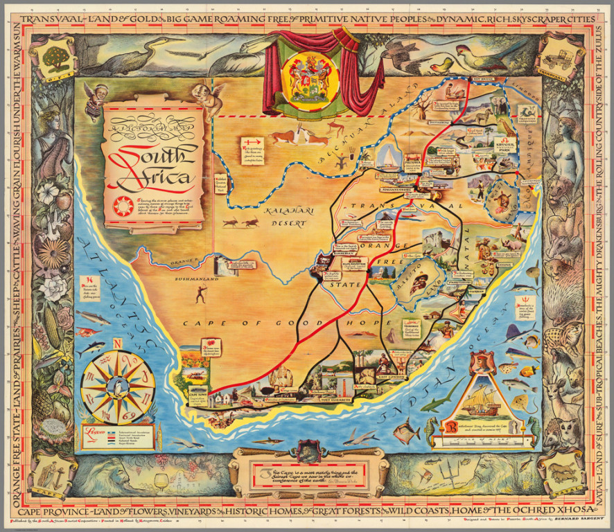
A Pictorial Map South Africa
Cartographer:
Sargent, Bernard
Date of Creation:
1950
This charming souvenir map was created by Bernard Sargent for the South African Tourist Corporation. The map shows the major roads and the sites that can be seen along those roads, representing "diverse places and extraordinary manner of strange things." An endorsement by Sir Francis Drake is also included: "This Cape is a most stately thing, and the fairest cape we saw in the whole circumference of the earth." The border is filled with images of native flora and fauna and gives brief descriptions of the main regions in South Africa: Transvaal, Natal, Cape Province, and Orange Free State. The map folds into a promotional brochure with additional maps on verso showing transportation routes by air, road, rail and sea and information on Durban and the Kruger National Park. This brochure was printed in the Netherlands by Rotogravure.
