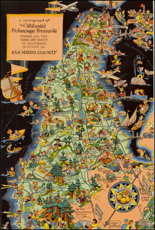
A Cartograph of California's Picturesque Peninsula
Cartographer:
White, Ruth Taylor
Date of Creation:
1940
White's pictorial map of San Mateo County in California:
The Golden Gate bridge is complete, but Treasure Island does not have the Exposition indicated, which suggests that this map precedes the map White drew for the Exposition Guide. Many familiar images here, including the Pan Am Clipper.
Taylor White’s pictorial maps, often known as cartographs, combine graphic style, color and comical observations. One of Ruth’s earliest commissions was for Frank’s alma mater, Stanford University: the front cover of “The Stanford Illustrated Review”, November 1927.
