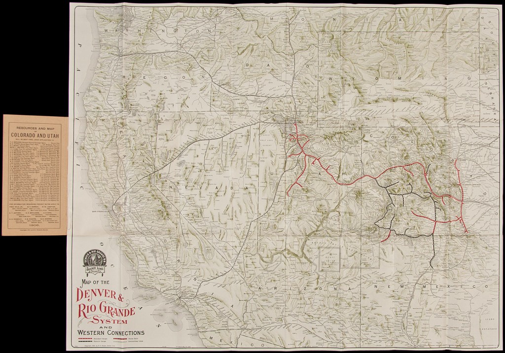
Map of the Denver and Rio Grande System and Western Connections
Cartographer:
Hooper, Shadrach K.
Date of Creation:
1906
Hooper's map of portions of Arizona, Colorado, Nebraska, New Mexico, Utah, and Wyoming, showing standard gauge, narrow gauge, three rails, and connecting lines, folds into paper wrappers with the title ‘Natural Resources of Colorado and Utah...’.
The verso of the map is covered with printed information on the Denver and Rio Grande System and the region it served, including a comparison of Colorado and Switzerland, in which Colorado comes out ahead.
Dan Edwards, local historian of Palmer Lake reports: "Hooper was known as the 'father of railroad publicity' and his extensive advertising efforts on behalf of the Rio Grande made the railroad known throughout America and Europe. Many prominent hotels, union stations, and ticket offices displayed pictures of scenery along the route of the Rio Grande that Hooper had provided. He arranged for the photographer, William H. Jackson and the writer, Ernest Ingersoll, to travel over the Rio Grande in special trains and record in pictures and words what they saw. Hooper popularized the Royal Gorge and the Black Canyon's Curicanti needle that served as emblems of the railroad. He also published several booklets on tourist spots and landmarks along the route of the Rio Grande.
“Hooper, like so many in development of the railroads, had learned the trade in the Civil War. He worked for five different lines before becoming general passenger and ticket agent for the Denver and Rio Grande in 1884, a position he held for decades, scaling back duties at the end of his career, finally retiring in 1917”.
