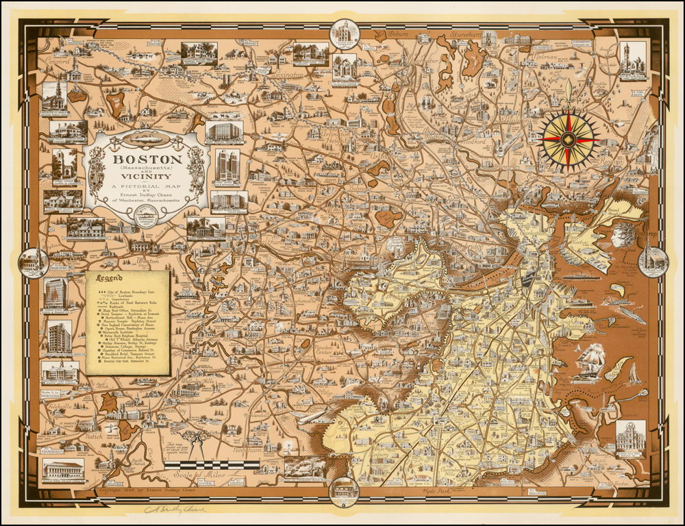
Boston (Massachusetts) and Vicinity
Cartographer:
Chase, Ernest Dudley
Date of Creation:
1938
Fine colour printed pictorial map of Boston and Massachusetts to the west from Concord in the north to Natick in the south, full of vignettes and depictions of historical and current landmarks, the title and key lower left, signed by the artist in pencil lower left.
A very detailed map, which in addition to just about every current and historical landmark imaginable, includes major road and railway, the ride of Paul Revere, as well as geographical features.
