
Featured Maps
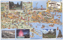
Sunny Hawkes bay, New Zealand
1960
A promotional map, probably produced by the local tourist bureau, centred on the towns of Hastings “The Fruit Bowl of New Zealand” and Napier “New Zealand’s Riviera”, in the Heretaunga Plains area, close to Hawke’s Bay, hom...
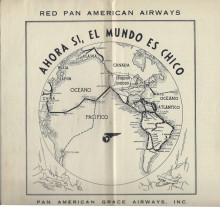
Mapa de Ruta. Pan American Grace Airways Inc.
1934
“Ahora Si, El Mundo es Chico” (Yes, now the World is smaller)A rare Spanish language route map and guidebook published by Pan American & Grace Airways Inc. The front cover is illustrated with a portrait of a DC-2, while inside is a small ...
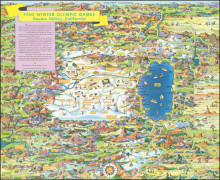
Your Shell Map of 1960 Winter Olympic Games. Squaw Valley California
1960
Commissioned by Shell Oil to promote their sponsorship of the 1960 Winter Olympic Games. The map shows not only the games’s site, but the surrounding area as far east as Virginia City (and including Lake Tahoe) and as far west as Grass Valley. ...
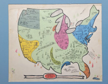
America for the Foot-Loose: An Indispensable guide for Married Couples Contemplating Seperate (sic) Vacations
c1952
Apparently unpublished, but possibly intended for publication in Esquire Magazine. There are many humorous little details… from “Farm house (ask for daughter)” to the red lights on Havana, Tijuana, Mexicali and Cuidad Juarez and on and o...
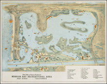
Sketch Map of the Proposed Development Mission Bay Recreational Area, San Diego
April 1945
The earliest published official depiction of the planned post-war development of the Mission Bay Recreational Area. The vision is Glenn C. Rick's, the City’s Planning Director, who had submitted the first suggested plan of development in 1935....
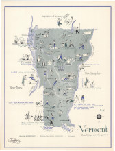
Vermont: Some History & Other Pastimes
1949
Published by local advertising and commercial design firm, Daly and Hamilton, the map covers all of Vermont with limited geographic detail but rich pictorial imagery. The numerous vignettes illustrate both historical elements, such as Calvin Coolidge...
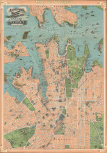
“A graphic representation of the Queen City of the South for the use of Tourists and Visitors” (front cover).
c1909
This “Map of Sydney”, “Showing principal Streets, Parks, Public Buildings, Tramways, &c., [was] published for sale at the Government Tourist Bureau,... and all Stationers”, and available from about 1909. The wharves between Mi...
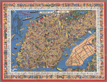
Wonders of New York
1953
Hansell’s ‘Wonders of New York’ captures the City at a major transition in the its life. “In 1958, more people crossed the Atlantic by airplane than by ship. Within a decade, the great ocean liners shown on the map were gone and...
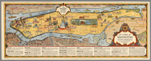
A Chart of Manhattan
1936
Annand “designed some of the most elegant and accessible pictorial maps of the period” (Hornsby).Extending to include the area from Battery Park and New York Harbour to the Bronx; and from New Jersey to Brooklyn and Queens. Originally publi...
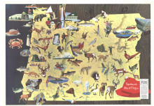
Sportsman's Map of Orego
1965
Published for the Blitz-Weinhard Brewing Co. of Portland, OR. The text welcomes both the “Sportsman” and the “Sport”. “Come on over to Oregon and Relax in a State of excitement”.Selander was a noted modernist waterc...
